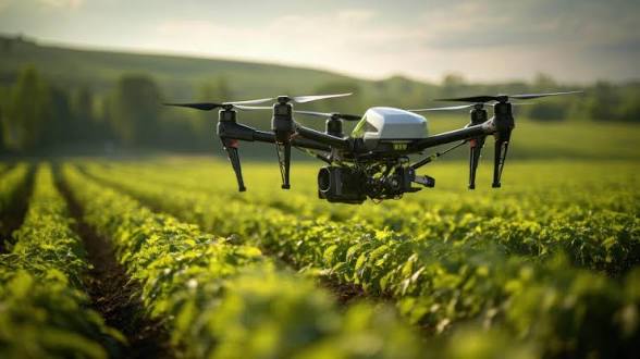
Quest Geomatics Consult continues to embrace cutting-edge technology to deliver accurate, efficient, and reliable surveying solutions. One of the most significant advancements in modern surveying is the use of Unmanned Aerial Vehicles (UAVs), commonly known as drones.
By integrating drone technology into our surveying operations, we are able to provide faster data collection, improved accuracy, and high-resolution aerial imagery that supports informed decision-making across a wide range of projects.
Enhancing Survey Accuracy
Drone surveys enable our professionals to capture detailed aerial data over large areas in a fraction of the time required by traditional survey methods. This technology produces highly accurate maps, orthophotos, and 3D terrain models, ensuring our clients receive dependable results for planning and development.
Faster Project Delivery
Time is a critical factor in construction, land development, and infrastructure projects. Drone-assisted surveying significantly reduces the time spent collecting field data, allowing Quest Geomatics Consult to complete projects more efficiently while maintaining the highest standards of quality.
Improved Safety
Certain survey locations can be difficult or hazardous to access. Drone technology enables our team to safely collect data from challenging environments such as steep terrain, wetlands, construction zones, and large industrial sites without exposing personnel to unnecessary risks.
Supporting Multiple Industries
Our drone surveying services support a variety of sectors, including:
Land development
Engineering and construction
Road and highway projects
Environmental monitoring
Agriculture
Mining
Infrastructure planning
Estate and property development
Delivering Better Value to Clients
The combination of advanced drone technology and professional surveying expertise allows Quest Geomatics Consult to provide cost-effective solutions without compromising quality. Clients benefit from quicker turnaround times, comprehensive project information, and accurate geospatial data for better planning and decision-making.
Our Commitment to Innovation
At Quest Geomatics Consult, innovation remains at the heart of everything we do. We continuously invest in modern surveying technologies and professional development to ensure our clients receive world-class geospatial solutions that meet international standards.
Whether you require boundary surveys, topographic mapping, engineering surveys, GIS services, or drone-based aerial mapping, our experienced team is committed to delivering precise, reliable, and professional results.
For enquiries or to learn more about our drone surveying services, contact Quest Geomatics Consult today and let us help bring accuracy and efficiency to your next project.
Comments (0)